
The PoCo Climb: Port Coquitlam’s Stair Workout, Step by Step
More than 200 stairs, a granite boulder scramble and three signed loops, from a 17-minute leg-burner to a 5 km tour of Citadel Heights. Here’s where to start, which loop to pick, where to park and how it stacks up against the Coquitlam Crunch.
Quick Answer
The PoCo Climb is a stair-and-trail workout in Port Coquitlam’s Citadel Heights, starting at 1500 Shaughnessy Street. It climbs from about 5 m to 75 m on more than 200 stairs, with a granite boulder scramble beside the upper section and views over ƛ̓éxətəm (Colony Farm) Regional Park. The City signs three loops: 1.1 km (about 17 min), 2 km (about 29 min) and 5 km (about 1 hr 11 min). Park on Shaughnessy Street, Eastern Drive or Western Drive. It’s free, open to everyone, and much shorter than the Coquitlam Crunch.
The fact sheet
| Start / finish | PoCo Climb, 1500 Shaughnessy Street, Port Coquitlam |
| Stairs | More than 200 (City of Port Coquitlam) |
| Elevation | About 5 m at Shaughnessy Street to 75 m at the top |
| Loops | 1.1 km · 2 km · 5 km |
| Time | About 17 min · 29 min · 1 hr 11 min (City estimates) |
| Signature feature | A granite boulder scramble beside the upper stairs, up to a summit landing |
| Difficulty | Short but steep. Easier than the Coquitlam Crunch; the scramble is optional |
| Parking | Street parking on Shaughnessy St, Eastern Dr and Western Dr |
| Dogs | On leash; off-leash areas at Skyline Park and Castle Park |
| Opened | Phase 1: July 10, 2024 · Phase 2: June 19, 2025 |
| Managed by | City of Port Coquitlam · Cost: free |
Port Coquitlam finally has its own stair climb
For years, if you lived in Port Coquitlam and wanted a stair workout, you drove to the Coquitlam Crunch. The PoCo Climb changed that. The City started building in March 2024, asked residents to name it (more than 1,600 suggestions came in), and opened the first phase on July 10, 2024. When it opened, the City said it hoped the PoCo Climb would become as familiar a name as the Grouse Grind.
What makes it different is how it fits into everyday life. The stairs start across Shaughnessy Street from ƛ̓éxətəm Regional Park, climb into Citadel Heights and link up with neighbourhood parks and the 25 km Traboulay PoCo Trail. That means you can do a 17-minute burst before work, or turn it into an hour-long loop with a playground or an off-leash park in the middle.
The three loops, and which one to pick

| Loop | Distance | Climbing | City time | Best for |
|---|---|---|---|---|
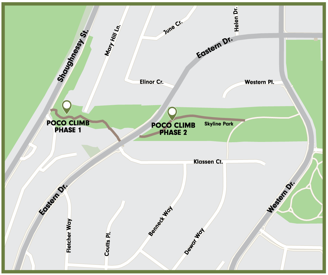
| Green | 1.1 km | 27 m | About 17 min | A quick stair session. Up the timber stairs and back down near Bennet Drive. |
| Blue | 2 km | 51 m | About 29 min | The full stair climb to Eastern Drive and through Skyline Park. The best “real” workout. |
| Orange | 5 km | 76 m | About 1 hr 11 min | The grand tour: stairs, Skyline Park, Settlers Park, Castle Park and the Fraser River. |
My suggestion for a first visit: do the blue 2 km loop. It covers every stair and the Skyline Park section in about half an hour, and you’ll know whether you want to repeat it, add the scramble, or save the full 5 km loop for a weekend.
The PoCo Climb, broken into three sections
Section 1 — The timber stairs: the wake-up call
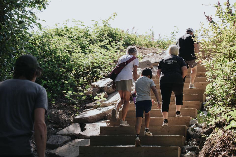
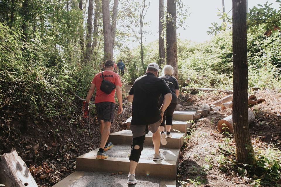
From Shaughnessy Street you’re climbing almost immediately. Phase 1 added more than 150 timber stairs up the wooded slope between Shaughnessy Street and Eastern Drive. It’s steep, shaded and quick, so most people feel it in the first couple of minutes. The green 1.1 km loop turns around near the top of this section and drops back down to the start.
Section 2 — Skyline Park and the scramble: the signature
Phase 2, which opened on June 19, 2025, carries the climb through Skyline Park toward Western Drive. When construction started, the City described a rising rock section of 122 continuous stairs with a granite boulder scramble running beside it, ending at a summit landing with unobstructed views of ƛ̓éxətəm Regional Park. The scramble is the part you won’t find on the Crunch: take the stairs if you want rhythm, or the boulders if you want to use your hands.
Phase 2 also improved the pedestrian crossing on Eastern Drive into Skyline Park and added wayfinding signs and bridge crossings built from natural materials. The blue 2 km loop runs through this section and comes back down the stairs.
Section 3 — The neighbourhood loop and the river: the long way home
The orange 5 km loop keeps going. From Skyline Park it passes Settlers Park, follows Colonial Drive down through Citadel Heights, crosses Citadel Drive into Castle Park, then crosses the Mary Hill Bypass and follows the city’s south edge by the Fraser River before heading back north up Shaughnessy Street to the start. It’s gentle after the stairs, and it shows you more of Citadel Heights in an hour than a week of driving through it.
How it compares with the Coquitlam Crunch
| PoCo Climb | Coquitlam Crunch | |
|---|---|---|
| Where | Citadel Heights, Port Coquitlam | Westwood Plateau, Coquitlam |
| Distance | Loops of 1.1, 2 or 5 km | 2.9 km one way |
| Elevation gain | About 70 m | 261 m |
| Stairs | 200+ | About 894 |
| Time | 17 min to about 1 hr 11 min | Most people take 45–75 min up and down |
| Extra | Granite boulder scramble; ties into the Traboulay PoCo Trail | Long, steady climb with valley views |
| Best for | Short, intense sessions; families; beginners building up | Serious endurance training |
They’re different workouts, not rivals. The Crunch is a long grind; the PoCo Climb is short and punchy, with a scramble and a choice of loop lengths. If you live in the Tri-Cities, it’s easy to use the PoCo Climb for quick weekday sessions and save the Crunch for the weekend.
Getting there, parking and what’s nearby
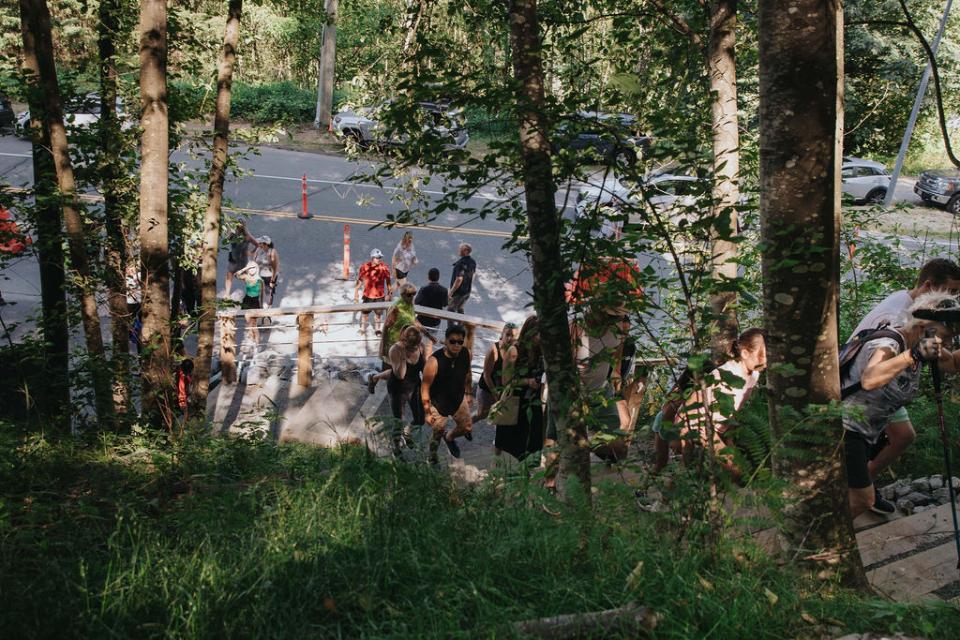
- Start: 1500 Shaughnessy Street, across from ƛ̓éxətəm Regional Park. A crosswalk with flashing beacons links the stairs to the regional park trails.
- Parking: street parking on Shaughnessy Street, Eastern Drive and Western Drive. There’s no dedicated lot. On busy mornings, park at the top on Eastern or Western Drive and start the loop downhill.
- Bikes: the City added bike racks with Phase 1, so you can ride in on the Traboulay PoCo Trail.
- Washrooms: none at the Shaughnessy start. When the route was announced, the City pointed to washrooms at Argue Street, Settlers Park and Castle Park on the longer loop.
- Dogs: on leash on the trail. Skyline Park Off-Leash Dog Area (1305 Eastern Drive) and Castle Park Off-Leash Dog Area (2252 Castle Crescent) are right on the routes.
- With kids: Castle Park has a spray park, which makes the 5 km loop an easy sell on a hot day.
Tips before you go
- Wear shoes with grip. Timber stairs and granite get slick in the rain, and this is the Lower Mainland.
- The scramble is optional. The stairs run right beside it. Skip the boulders with small kids, dogs or wet weather.
- Go down carefully. On the short loops you descend near the stairs; take it slow if your knees complain.
- Turn it into a circuit. Repeat the blue loop two or three times for a hill workout that takes under 90 minutes.
- Add the flats. Cross to ƛ̓éxətəm Regional Park for a cool-down on the Traboulay PoCo Trail.
How the PoCo Climb was built
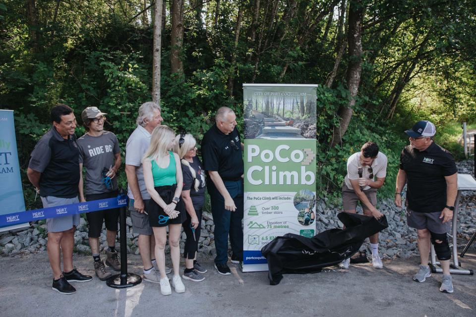
- March 12, 2024: construction began, and the City opened a public naming contest.
- July 10, 2024: Phase 1 opened with a ribbon cutting. Reported cost: $400,000, on time and under budget. The name “PoCo Climb” came from more than 1,600 public suggestions.
- Fall 2024 to spring 2025: Phase 2 was delayed by late material deliveries and bad weather, including an atmospheric river.
- June 19, 2025: Phase 2 opened at the new stair section in the 1200 block of Eastern Drive. The first 100 people to finish it got a commemorative towel.
What it means for buying or selling nearby
The PoCo Climb is the kind of amenity that quietly changes how a neighbourhood is described. Before 2024, Citadel Heights was “close to the river trails.” Now it has its own signature workout, an off-leash park at the top of the stairs and a direct walking link to ƛ̓éxətəm Regional Park.
- For buyers: homes in Citadel Heights near Shaughnessy Street, Eastern Drive and Western Drive put the stairs within a few minutes’ walk. If you’re comparing PoCo with Westwood Plateau because of the Crunch, this is worth a look.
- For sellers: if your home is within an easy walk of the stairs, it belongs in the listing description with the actual walking distance, not a vague “close to trails.”
- Be realistic: one trail doesn’t set a home’s price. It helps a home stand out, but price still comes from recent comparable sales. My Port Coquitlam home value guide is a good place to start.
Frequently asked questions
Where does the PoCo Climb start?
The City uses PoCo Climb, 1500 Shaughnessy Street, Port Coquitlam as the start and finish for all three loops. The stairs climb east from Shaughnessy Street toward Eastern Drive and Skyline Park, across the road from ƛ̓éxətəm (Colony Farm) Regional Park.
How many stairs are on the PoCo Climb?
More than 200, according to the City. Phase 1 (opened July 2024) added more than 150 timber stairs between Shaughnessy Street and Eastern Drive, and Phase 2 (opened June 2025) added a rock stair section through Skyline Park, which the City described as 122 continuous stairs, plus a granite boulder scramble beside them.
How long does the PoCo Climb take?
The City’s route map gives three loops: 1.1 km with 27 m of climbing in about 17 minutes, 2 km with 51 m in about 29 minutes, and 5 km with 76 m in about 1 hour 11 minutes. Fit regulars will be faster; families with young kids should allow extra time.
How high is the PoCo Climb?
It rises from about 5 metres above sea level at Shaughnessy Street to about 75 metres at the top, a gain of roughly 70 metres. That’s much shorter than the Coquitlam Crunch, which gains 261 metres, so it suits quick workouts and beginners.
Where do I park for the PoCo Climb?
The City says street parking is available on Shaughnessy Street, Eastern Drive and Western Drive. There is no dedicated parking lot, so on weekends it can be easier to park on Eastern or Western Drive and start the loop from the top.
Is the PoCo Climb dog-friendly?
Dogs are welcome on leash. Two City off-leash areas sit on or near the routes: Skyline Park Off-Leash Dog Area (1305 Eastern Drive) and Castle Park Off-Leash Dog Area (2252 Castle Crescent). Watch smaller dogs on the boulder scramble.
Are there washrooms on the PoCo Climb?
Not at the Shaughnessy Street start. When the City announced the route, it pointed to washrooms at Argue Street, Settlers Park and Castle Park on the longer loop, so plan ahead and check on the day.
Is the PoCo Climb harder than the Coquitlam Crunch?
No. The Crunch is a 2.9 km one-way climb with 261 metres of elevation gain and about 894 stairs. The PoCo Climb gains about 70 metres and has more than 200 stairs, spread over loops of 1.1 to 5 km. The boulder scramble adds a technical option the Crunch doesn’t have.
Does the PoCo Climb connect to the Traboulay PoCo Trail?
Yes. The City built it as part of the Traboulay PoCo Trail network. A crosswalk with flashing beacons on Shaughnessy Street links the stairs to ƛ̓éxətəm Regional Park, and the 5 km loop returns along the city’s south edge by the Fraser River before heading back up Shaughnessy.
Sources & Methodology
Every fact about the trail comes from the City of Port Coquitlam or local news coverage of its announcements:
- City of Port Coquitlam — PoCo Climb page and route map (portcoquitlam.ca/pocotrek). Source for: start address, the three loops with distance, climbing and time, stairs, elevation, parking, phase details and all images in this post.
- City of Port Coquitlam — “Construction Begins on Unnamed Trek” (March 12, 2024), “Phase 2 Underway” (January 30, 2025) and “PoCo Climb Reaches New Heights” (June 12, 2025). Source for: timeline, naming contest, 122-stair rock section, boulder scramble, crossing improvements and the Phase 2 opening.
- City of Port Coquitlam — Dog parks (portcoquitlam.ca/dogparks). Source for: Skyline Park and Castle Park off-leash areas.
- Tri-City News (Phase 1 opening coverage, July 2024; route announcement, March 2024; Phase 2 update, 2025). Source for: $400,000 Phase 1 cost, 1,600+ name suggestions, trailheads and washroom locations announced for the loop, and Phase 2 delays.
- Daily Hive (July 13, 2024 and June 2025). Source for: the Grouse Grind comparison, bike racks and the commemorative towel.
- City of Coquitlam via my Coquitlam Crunch guide for the Crunch comparison figures.
Methodology: loop distances, climbing and times are the City’s published figures; actual times vary with fitness and stops. The stair total is the City’s current figure (“over 200”); earlier announcements gave different counts during planning. Images are the City of Port Coquitlam’s, credited under each one. Facts checked October 11, 2026.
Signed: Craig Johnston, REALTOR® V99960 · Royal LePage Elite West
Looking at homes near the PoCo Climb?
I’ll show you which Citadel Heights streets put the stairs, Skyline Park and the river trails within a short walk, and price them against recent sales in the same pocket.
Direct: 604-202-6092 · Craig@SoldByCraig.ca