
Eagle Mountain · Coquitlam · 4x4 access
Eagle Mountain has one of the best summit views in the Lower Mainland — Indian Arm to the south-west, the Burrard Inlet and Vancouver to the west, the Fraser Valley to the south. You cannot just drive up. The vehicle gate is locked. With City of Coquitlam approval and a key, residents can drive the access road. Here is the real local read on how it works, what the road is like, and what you actually see at the top.
Quick Answer
What should you know about Eagle Mountain 4x4 Coquitlam?
Eagle Mountain (Coquitlam) has a locked vehicle gate. With City of Coquitlam approval and a key, residents can drive the access road to the summit — view of the Lower Mainland, Indian Arm, and the Burrard Inlet. A Burke Mountain resident Craig Johnston, Top 1% Team Member — Greater Vancouver REALTORS® and 47+ year Tri-Cities resident, can walk you through the local context. Free Strategy Call ends with a written one-page plan in 24 hours.
Coquitlam outdoor recreation · 4x4 access
Eagle Mountain rises east of Anmore and Coquitlam, on the edge of the watershed network that supplies a meaningful portion of the Lower Mainland's drinking water. The summit is reachable by vehicle on a maintained access road that climbs through the upper forest — but the gate at the bottom is locked, and the access is controlled. With approval and a key, you can drive it. Without those, you're walking from a long way down.
This page is what a Burke Mountain resident can tell you about that climb. The view from the top. What's visible from the summit. Why it matters when you're weighing where to live in the Tri-Cities. And the practical question buyers ask once they realize Eagle Mountain is right there: how do you actually get up there?
Access · the locked gate
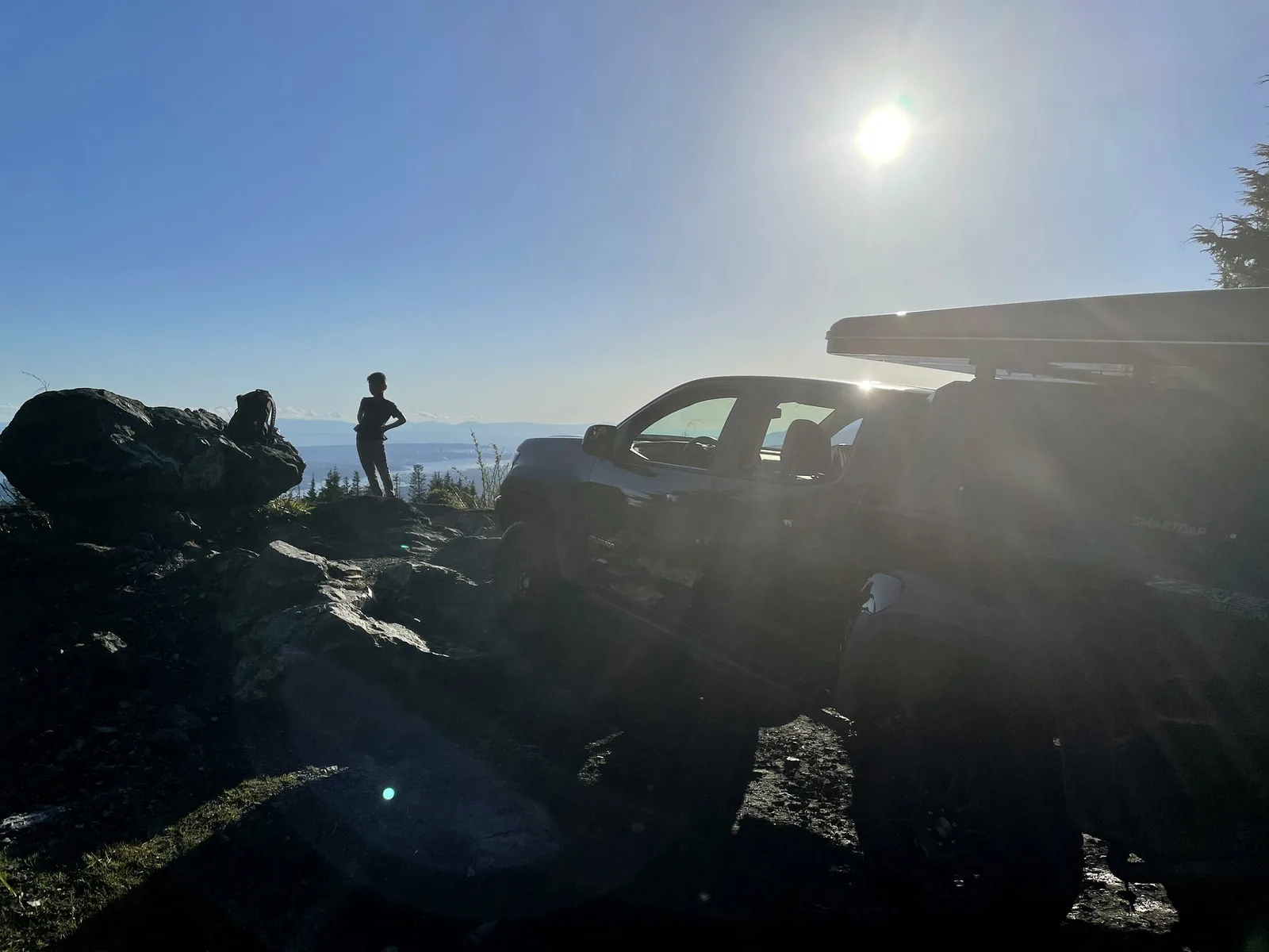
Vehicle access on the upper Eagle Mountain road is controlled by a locked gate. The reasons are good ones — the area is part of the broader watershed network, the road climbs through forest with active wildlife and recovery work, and unmanaged access creates real risks for the ecosystem and for the people on the road.
For residents who want to drive up — for a family afternoon at the summit, for trail access higher than the foot of the mountain, for the kind of personal connection to the land that makes living here feel like a privilege rather than a postal code — there is a process. The City of Coquitlam controls access. With approval, you get the key code or a temporary lock combination, and the gate opens to authorized vehicles.
How to request key access
The Eagle Mountain key program is administered by the 4 Wheel Drive Association of British Columbia (4WDABC). Members in good standing can apply for a key through the Association's Eagle Mountain key program — this is the practical route most authorized residents and clubs use to access the upper road.
Get Eagle Mountain key access →
You can also contact the City of Coquitlam directly via coquitlam.ca for current information on the locked-gate access process. Application requirements, fees, and seasonal restrictions can change — verify directly with 4WDABC and the City before driving up.
A few things worth knowing before you apply: access is limited and conditional, the road conditions vary with weather, the gate hours can change seasonally, and the rules around what you can and cannot do on the upper road exist for reasons that matter. If you treat the access as a privilege rather than an entitlement, the system works the way it is designed to.
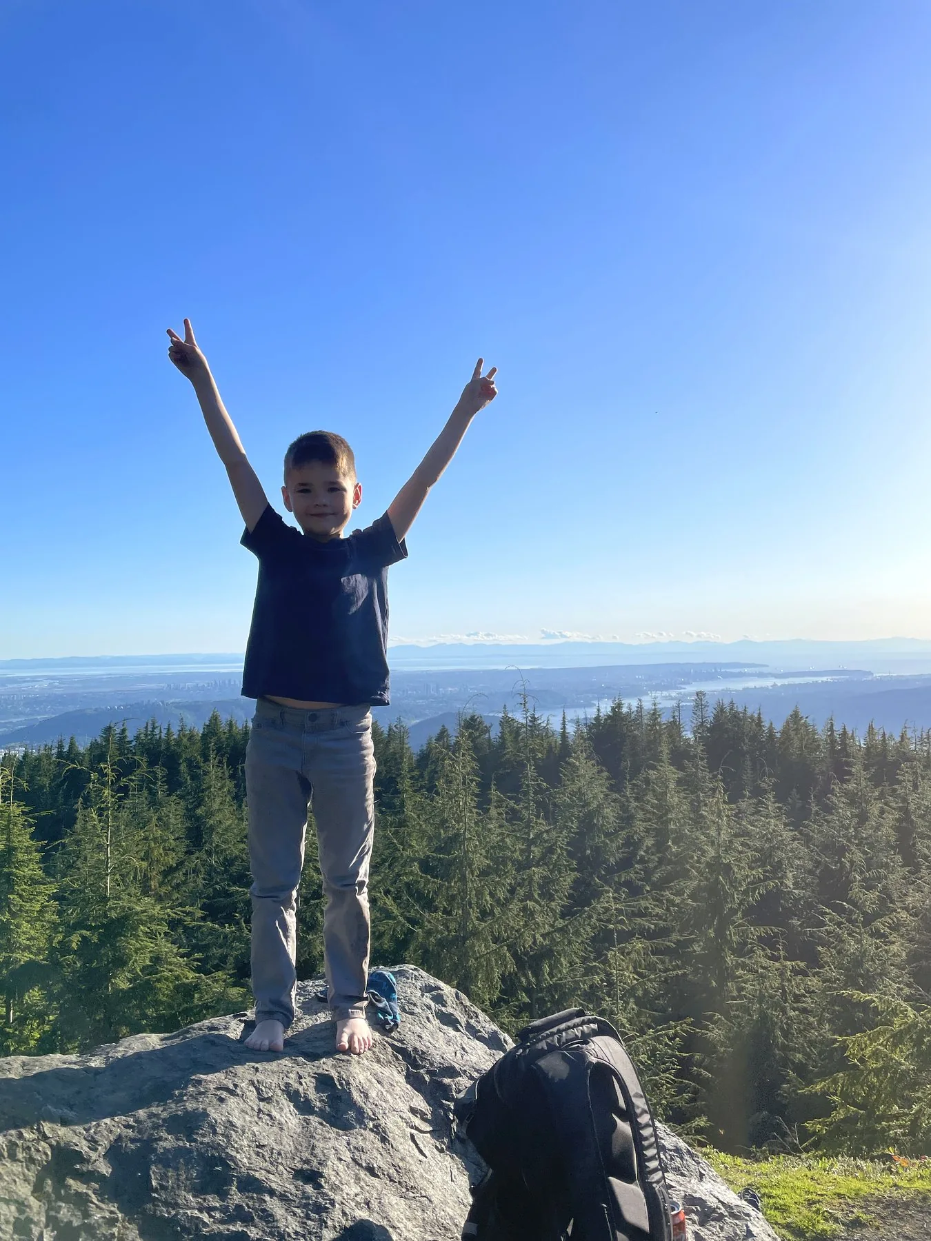
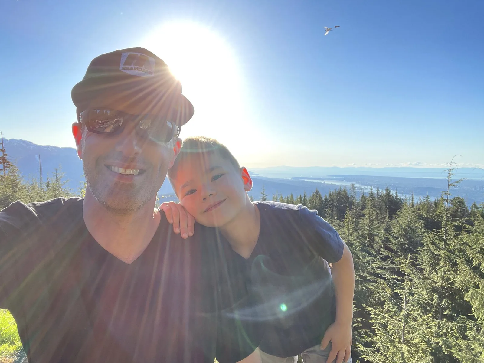
From the summit · the real view
The view from the top of Eagle Mountain is the kind of view that gets photographed on a phone, gets shown to relatives the next time they visit, and never quite lands the same way through the screen. South-west, you see Indian Arm running its full length toward Vancouver. To the west, Burrard Inlet, downtown, the Lions Gate Bridge if the air is clear. To the south, the Fraser Valley spreading out past Coquitlam Centre and Lougheed.
For Burke Mountain and Anmore residents who think of Eagle Mountain as just the green wall east of their neighbourhood, getting up to the summit reframes the geography. You're not living near a mountain. You're living on the edge of a watershed that connects to one of the most beautiful inlets on the BC coast — and the summit is where that geography becomes visible.
The full length of the fjord visible on a clear day. The Belcarra side, the Deep Cove side, Granite Falls in the distance. Boats from above look like white pinpricks on dark water.
Downtown Vancouver, the Lions Gate Bridge on a clear day, the North Shore mountains. The view that explains why people pay what they pay to live on this side of the inlet.
Coquitlam Centre below. Lougheed and Burnaby beyond. On the clearest days, Mount Baker rising over the valley to the south-east.
For Tri-Cities buyers
When buyers compare Burke Mountain, Anmore, Westwood Plateau, and Heritage Mountain, the conversation usually centres on schools, build quality, commute, and price. Those matter. They're also the conversation every other REALTOR in the region is having.
The factor most non-residents cannot weigh is the lifestyle one. Living where Eagle Mountain access is part of your weekend rhythm — where you can apply for the gate code, climb the road, and reach a summit that views three watersheds — is genuinely different from living near a city park or a strip mall. It is one of the things Tri-Cities families who actually use the outdoors talk about with the people they trust. And it is one of the reasons the region trades at a premium even when the lower-Coquitlam price-per-foot looks higher than alternatives across the inlet.
When you ask a Tri-Cities REALTOR whether they have actually been up Eagle Mountain, you find out fast whether you are working with someone who has lived the place or just sells it. The right REALTOR can tell you what the road is like at 6 a.m. on a Saturday, what the bear activity has looked like in the last few summers, and what the gate-code process actually feels like from the application end. Those are the layers that turn a listing into a home decision you do not regret.
Frequently asked
No. The vehicle gate at the foot of the upper-Eagle Mountain access road is locked. Vehicle access requires authorization from the City of Coquitlam. Without approval, the road is closed to vehicles — though it is still possible to walk or hike the lower portion in many cases.
Contact the City of Coquitlam directly. Visit coquitlam.ca and ask Parks & Recreation about the current Eagle Mountain access process. They will direct you to the current request form, document any approval requirements, and explain the lock-code process. Always verify directly with the City — the application path can change year to year.
The Eagle Mountain corridor sits within the broader Metro Vancouver watershed and recreation network. Limiting unmanaged vehicle access protects the ecosystem, manages wildfire risk during dry seasons, prevents road damage, and keeps the area usable for the residents and authorized users who do have access. It is not a token gesture — it is functional management.
A 4x4 SUV or pickup is the practical answer. The road climbs significantly, surfaces vary, and weather conditions can change rapidly. A two-wheel-drive sedan is not the right tool for this drive. Reasonable ground clearance, all-terrain or dedicated off-road tires, recovery gear, and a full tank of fuel before the climb are sensible defaults.
Yes — once you have the access approval and the right vehicle. The drive is appropriate for a family afternoon if the weather is dry, the day is clear, and you bring water, snacks, and the basics. The summit views are exactly the reason families do this drive in the first place.
On a clear day: Indian Arm running south-west toward Vancouver, Burrard Inlet and the city itself, the Lions Gate Bridge, the North Shore mountains, the Fraser Valley spreading south, and Mount Baker on the horizon to the south-east. On overcast days the view is more local but still meaningful — Burke Mountain, the Coquitlam corridor, the trail networks visible from above.
Cooler than the valley floor, frequently windier, and noticeably variable. A summer Saturday at the summit can be a t-shirt afternoon at noon and a fleece-jacket afternoon by 3:30 p.m. once the wind picks up. Pack layers and check forecasts, including wind, before you climb.
Yes. Black bears live in this corridor. Treat the area with the same respect you would treat any working BC ecosystem. Make noise on foot, do not leave food or wrappers in the open, follow standard bear-aware protocols, and remember that the road is shared with the wildlife that has been here longer than the road has.
Practically, yes — though the access program is administered by the City of Coquitlam rather than tied to specific addresses. Anmore, upper Burke Mountain, and other east-Coquitlam neighbourhoods are the natural communities for residents who want regular Eagle Mountain access because they sit closest to the gate. Buyers thinking about the Tri-Cities outdoor lifestyle should weigh that proximity in their location decision.
Anmore village and the Eagle Mountain Drive corridor are the closest residential neighbourhoods to Eagle Mountain access. From those streets, the climb starts essentially out the front door. Upper Burke Mountain, Heritage Mountain, and parts of north Coquitlam are the next-closest tier — adding a short drive to reach the lower access roads.
Continue your Tri-Cities outdoor research
Legacy authority
A resident's lifetime record across the Tri-Cities — schools, parks, trails, water, and the rest of the lived list.
Neighbourhood
The closest residential community to Eagle Mountain access on the Coquitlam side. Family detached, mountain trails, the David Avenue spine.
Neighbourhood
The community that sits at the foot of Eagle Mountain Drive — the literal closest residential neighbourhood to the access road.
Outdoor
The trail network on the next mountain over — Pinecone-Burke Provincial Park, Coquitlam Crunch, and beyond.
Craig Johnston is a generational Coquitlam REALTOR® — Burke Mountain resident, Tri-Cities native, the kind of agent whose family afternoons happen at the summit of the mountain his clients are buying near. The lifestyle layer of a real estate decision is something most agents cannot speak to with credibility. Craig can.
Tri-Cities monthly
June 2026 Coquitlam detached HPI is $1,649,000, -4.8% YoY. What that means for your buy or sell decision — without the salesy fluff. One email per month. Unsubscribe anytime.
No spam, no listings flood, no marketing automation games. Genuine monthly update from a 47+ year Tri-Cities resident.